

Raven's Barrow [Cartmel Fell]
Good walks are even better shared.
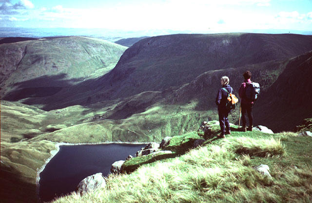
SD4188 : On Raven's Barrow
Michael Graham Photo source
Overview
Raven's Barrow [Cartmel Fell]
Raven's Barrow, a prominent Marilyn within the Lake District, offers hikers a delightful mix of scenic views and manageable terrain. Standing at an elevation of 288 meters, this gem is perfect for both seasoned trekkers looking for a quick hike and newcomers eager to explore the beauty of the area.
Geology
The mountain’s geology is primarily composed of sedimentary rocks, namely mudstones and shales. Formed millions of years ago in ancient marine environments, these rocks contribute to the lush vegetation found in the area, providing a suitable habitat for various wildlife.
Routes
One popular route, the Cartmel Fell Loop, spans approximately 8 km and can be completed in about 3 hours. This moderately challenging loop offers a gentle ascent, making it accessible for families and casual walkers. The paths are well-marked, but be cautious of wet sections after rain.
Summit Features
At the summit, you'll find a humble cairn standing sentinel. It's not adorned with bling like some higher peaks, but it offers a serene spot to rest and take in the views without the bustle of more popular hiking spots.
Terrain
Expect grassy slopes interspersed with rocky sections, particularly as you near the summit. Good footwear is advisable to navigate the occasional slippery bits.
Views
The summit rewards hikers with breathtaking views of Morecambe Bay and the rolling hills of the southern Lake District, including the majestic Coniston Range. On particularly clear days, the distant Yorkshire Dales make a stunning appearance, so don’t forget to bring your camera!
Hazards
Despite its inviting nature, hikers should be aware of the following hazards: wet and slippery paths, particularly after rain, can make the journey precarious. Additionally, visibility may drop significantly in misty conditions, so ensure you've got your bearings before heading up. And, of course, keep an eye out for sheep—they're the real locals here!
Nearby Summits
Just a short distance away, you can explore Gummer's How (196 m) and Whitbarrow Scar (215 m), both of which are great options for those wishing to extend their mountain adventures.
Access
To access Raven's Barrow, the nearest parking spots are available along the A590. Make sure to park considerately, keeping in mind local residents. Public transport options include the 555 bus, which services Cartmel from Grange-over-Sands.
Facilities
After a rewarding hike, consider stopping in the lovely village of Cartmel. Known for its charming cafés and friendly pubs, it’s the perfect place to refuel and reflect on your day out.
History
The name 'Raven's Barrow' hints at its Norse roots—'hrafn' meaning 'raven' and 'barrow' referring to a hill. Historically, this area is significant, lying close to the medieval village of Cartmel and its ancient priory.
In conclusion, Raven's Barrow is an accessible yet rewarding hiking destination, perfect for anyone looking to connect with nature without the hustle and bustle found on some other peaks. Happy hiking!
Explore routes near Raven's Barrow [Cartmel Fell]
Walks starting near this hill. Open a route to check its map, distance and full itinerary.
Sizergh: Park End Moss and Brigsteer Park Wood Circuit
View route
Coniston to Tarn Hows: Monk Coniston Gardens and Woodland Circuit
View route
Tarn Hows Fast Route
View route
Great Carrs Halifax Wreckage from Wrynose Pass
View route
Route planning notes
These notes describe possible approaches. Check a route's map and access information when planning your walk.
The Cartmel Fell Loop
A scenic loop that offers a gentle ascent and stunning views of the surrounding countryside.
Make a day of it, together
Find someone to share the walk with, or organise a day out along a route you like.
Photo Gallery
View all Photo could not load
SD4188 : On Raven's Barrow
Michael Graham
 Photo could not load
SD4187 : The cairn on Raven's Barrow
David Brown
 Photo could not load
SD4187 : Looking north from Raven's Barrow
Karl and Ali
 Photo could not load
SD4187 : Outcrops, Raven's Barrow
Karl and Ali
 Photo could not load
SD4187 : Cairn on Raven's Barrow
Michael Graham
 Photo could not load
SD4187 : The monument (cairn) on Raven's Barrow
Karl and Ali
 Photo could not load
SD4187 : The monument on Raven's Barrow
Karl and Ali
 Photo could not load
SD4187 : On Raven's Barrow
Michael Graham
 Photo could not load
SD4187 : The cairn on Raven's Barrow (Cartmel Fell)
David Purchase
Hill facts and local notes
Classifications
Elevation
152m
499 ft
Prominence
0m
Coordinates
54.2836, -2.9035
SD412879
OS Map
96 97
Explorer: OL7S
At the Summit
At the summit, you'll find a small cairn but no trig point, making it a wonderfully peaceful spot to enjoy your well-deserved rest after the hike.
Terrain & Geology
The mountain is primarily composed of sedimentary rocks, including mudstones and shales, which were laid down in ancient marine environments. The weathering of these rocks has created rich soil, supporting diverse flora.
Views & Scenery
From the summit, enjoy sweeping views of Morecambe Bay, the southern Lake District mountains including the Coniston Range, and on a clear day, the distant peaks of the Yorkshire Dales.
History & Heritage
Name Origin
The name 'Raven's Barrow' likely derives from the old Norse words 'hrafn' (raven) and 'barrow' (hill), suggesting a place frequented by these intelligent birds.
Historical Significance
The area has historical significance due to its proximity to the ancient village of Cartmel, known for its medieval priory and local traditions.
Getting There & Facilities
Parking
There is a small roadside parking area along the A590, approximately 3 km from the summit. Be sure to park considerately.
Public Transport
The nearest bus stop is in the village of Cartmel, serviced by the 555 bus from Grange-over-Sands.
Nearby Facilities
The quaint village of Cartmel offers several cafés and pubs where hikers can refuel, but remember to check for opening times, especially off-season.
Safety Information
Known Hazards
- Wet and slippery paths after rain, low visibility in misty conditions, and sheep grazing along the trails.
General Safety Tips
- Check weather conditions before setting out
- Carry appropriate clothing and equipment
- Let someone know your planned route
- Take a map, compass, and GPS device
- Carry emergency supplies: food, water, first aid kit, torch
Hills
Some common questions about the hills answered
Are there group walks up Raven's Barrow [Cartmel Fell]?
Many walkers use Walkmates to join or organise walks with others. You can check for group walks around Raven's Barrow [Cartmel Fell] through the maps
Are there other walkers around Raven's Barrow [Cartmel Fell]?
Activity varies by location and time, but Walkmates lets you see whether others have shared walks or shown interest in this area. Find other people through the walking friends search walking friends for Raven's Barrow [Cartmel Fell] search or of course create your own walk for Raven's Barrow [Cartmel Fell]
Can I organise a walk to Raven's Barrow [Cartmel Fell]?
Yes. If there aren’t any walks listed already, you can create a walk and make it available for others to join.
If you're signed up to Walkmates, you can create a walk to Raven's Barrow [Cartmel Fell].
How do I find a walk up this hill?
There are often multiple ways to walk this hill, depending on experience and route preference. Walkmates helps you explore walks and routes that others have shared.
Can I suggest a new route up Raven's Barrow [Cartmel Fell]?
Yes. You can suggest or create routes to share with others. Walkmates focuses on the social side of walking, so routes are used to help people organise walks and explore areas together, rather than as detailed navigation tools or route libraries.
Other uses really appreciate knowledgeable walkers sharing their routes. Share your favourite route to Raven's Barrow [Cartmel Fell] here
The is an error or something incorrect about this hill. How do I let you know?
We always strive to keep the information on Walkmates as accurate as possible. If you find an error, please let us know through the contact form and we'll aim to correct it as quickly as possible
Community Discussion
Comments
Location
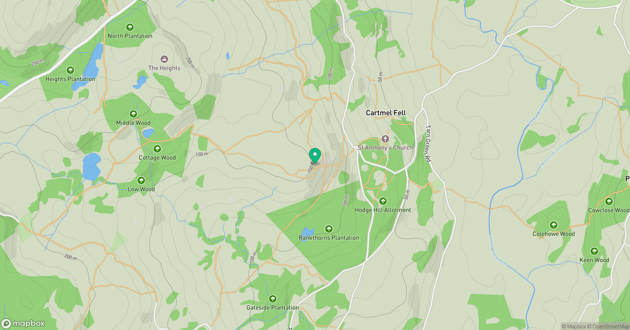
Grid reference: SD412879
View on OpenStreetMapOpens a map in a new tab, centred on the hill.
No comments yet. Be the first.